Short Manaslu Tsum Valley TrekShort Manaslu Tsum Valley Trek

Short Manaslu Tsum Valley Trek

Tsum Valley Manaslu Short Trekratingbased on 1 review
  • Duration21 Days
  • Difficulty Level Strenuous
  • Activity Trekking/Hiking
  • Max. Altitude 5106 meters
  • Starts Kathmandu
  • Ends Pokhara/Kathmandu
  • Group Size 1-20
  • Best Season September To November and March to May
Group Discount Prices
  
2 - 3 paxUS$1290
4 - 6 paxUS$1190
7 - 10 paxUS$1145
11 - 15 paxUS$1090
16 - 20 paxUS$1045
Short Manaslu Tsum Valley Trek Highlights
  • Venture into the hidden, sacred valley of Tsum, rich in Tibetan Buddhist culture and tradition.
  • Visit the legendary Milarepa cave.
  • Get a chance to stay overnight at the Mu Gompa Monastery. 
  • Explore ancient monasteries like Rachen Gompa and Dhephu Doma Gompa. 
  • Trek over one of Nepal’s most spectacular high mountain passes, Larkya La Pass, with stunning views of Himlung, Cheo Himal, Kang Guru, and Annapurna II.
  • Enjoy a side hike from Samagaun to the base camp of Mount Manaslu (8,163 meters).
  • Trek through lush forests, river valleys, alpine meadows, and glacial terrains; possibly spot blue sheep, Himalayan tahr, and lammergeiers.
  • Experience the unique blend of Tibetan and Nepalese cultures in remote mountain settlements.

Short Manaslu Tsum Valley Trek Overview

Nestled in the Gorkha District of north-central Nepal, the Short Manaslu Tsum Valley Trek leads you through two of Nepal’s most remote and restricted regions: Tsum Valley and the Manaslu Conservation Area. Geographically, the trail runs parallel to the Tibetan border, and the region itself opened to foreign trekkers only in 1991. 

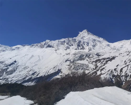
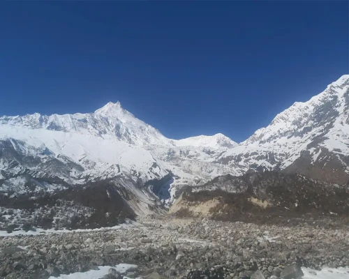
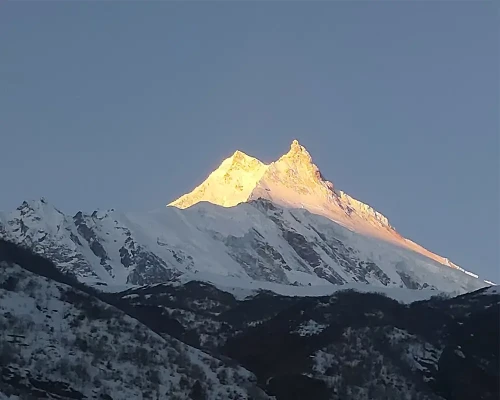
During this journey, you will gradually ascend through deep river gorges, subtropical forests, alpine meadows, and high mountain passes. Along the way, you will be rewarded with panoramic views of Mount Manaslu. From the route of Larkya La to Bhimthang, you will get breathtaking views of Himlung Himal, Cheo Himal, and Annapurna II.

Besides landscapes, this trek takes you into the hidden Buddhist valley of Tsum, a place that remained sealed off from the outside world until 2008. Often referred to as the “Beyul” or sacred hidden valley, the origins of Tsum Valley are deeply rooted in the historical migration of Tibetan people who fled their homeland during times of conflict with China. Within Tsum Valley, they found safety and spiritual solace. 

Scenic Beauty And Cultural Richness

The Short Manaslu Tsum Valley Trek begins in the warm foothills of the Manaslu region. You will pass the low-altitude villages, of Machha Khola, and Jagat. The trail winds through subtropical forests and suspension bridges, past waterfalls and steep cliffs. 

Soon after, you will enter the mystical Tsum Valley via Lokpa, the first village of the valley. Here, the subtropical slowly transitions to pine-scented trails and dramatic cliffs with views of cascading waterfalls. As you head deeper into this valley, you will pass traditional villages like Chumling and Chhokangparo. 

The trail here becomes narrower and more remote with a mix of forested paths and exposed ridgelines. Along these forested trails above tree lines, you might encounter Himalayan thar, musk deer, and langurs swinging through the woods.

Moving on, these villages are known for their strong Tibetan roots, ancient stone houses,and warm-hearted locals who still follow age-old traditions. Throughout the Tsum Valley, you will encounter a culture that is deeply spiritual and distinctly Tibetan. Villages are dotted with mani walls, chortens, and centuries-old gompas. 

One of the significant cultural highlights of the trek is the overnight stay at Mu Gompa, the highest monastery in the valley. Before you reach Mu Gompa, you will make a stop at  Milarepa cave. 

As you leave Chhokang Paro behind, you will pass through alpine meadows and terraced farms lined with mani walls and colorful prayer flags. The trail to the cave is moderately steep with rocky footpaths.

Upon reaching Milarepa cave nestled near the Bursi village, you will find a small monastery built into the cliffside. This cave is a sacred site where the legendary Tibetan saint Milarepa is believed to have meditated.

With this quick visit to the site, you will pass through Rachen Gompa and Dhephu Doma Gompa to join the trail of the Manaslu Circuit at Lokpa.

The Manaslu Circuit section begins with a transition in both landscape and altitude. Villages like Bihi Phedi and Namrung rise above dense rhododendron forests and reveal increasingly rugged terrain. 

Further along, the trail is flanked by yak pastures, pine forests, and endless mountain views as you make your way to Shyala. After this stop, you will move towards Samagaun. It is the heart of the Manaslu Circuit as well as the base for a spectacular day hike to Manaslu Base Camp (4,800 meters). 

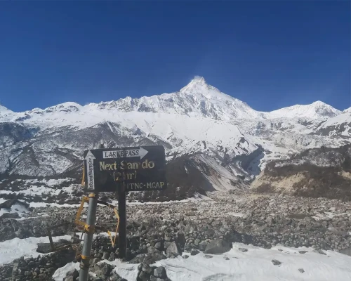
Following this acclimatization day, the trek takes its final stretch towards Samdo, which is a village just below the Tibetan border. From here, the trail ascends through barren alpine zones to Dharamsala, the last stop before the Larkya La Pass.

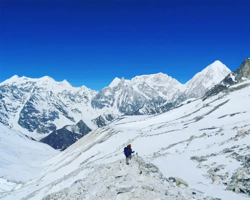
The hike to the Larkya La Pass is one of the challenging sections of the trek. You will start this hike in the pre-dawn hours. The trail is quite rugged with alpine landscapes of glacial moraines and snow-dusted boulders.

Nearing the summit of this pass, you will gradually witness the revealing views of Himlung Himal, Cheo Himal, Kang Guru, and the Annapurna II massif. The summit is filled with colorful prayer flags and the hiking experience itself is humbling and otherworldly.

Then, you will take a long but spectacular descent to Bhimthang, passing through glacial valleys and panoramic scenery. Following the wild alpine basin of Bhimthang, you will reenter the forested mid-hills, gradually trading high-altitude drama for lush valleys, waterfalls, and traditional Gurung communities in Tilije.

Useful Information

Short Manaslu Tsum Valley Trek Difficulty

Despite its shorter version, this trek is a moderately to highly challenging one that requires both physical endurance and mental determination. Here's a breakdown of the key difficulty factors:

Altitude & AMS

The trek starts from the lower hills of Machha Khola (870 meters) and climbs steadily to Larkya La Pass (5,160 meters). Over the days, this dramatic gain in elevation exposes you to the risk of Acute Mountain Sickness (AMS). 

Generally, as you move from Samagaun (3,530 meters) upward, thinner air and lower oxygen levels highly trigger symptoms like headaches, nausea, and breathlessness if you are not properly acclimatized. 

Trail Conditions & Terrain

The trail of Manaslu Tsum Valley offers a constantly changing terrain. Early on, you will walk through dense forests, bamboo groves, and terraced fields, often on narrow paths. As you enter Tsum Valley, you should expect steep ascents, exposed ridges, and trails surrounded by rhododendron and pine forests. 

Following it, the route gets increasingly rugged and alpine once you rejoin the Manaslu Circuit, up until Namrung. The trails are generally rocky with glacial moraines and snow-covered passes, especially around Larkya La.

Daily Walking Hours & Physical Strain

Each trekking day on this trail ranges from 6 to 8 hours, though some days, like the Larkya La crossing, can stretch to 10 hours or more. During this trek, you will have to face prolonged climbs, continuous altitude gain, and several descents over loose rocks.
These harsh walking hours may lead to muscle fatigue and exhaustion. Hence, you will need a decent level of fitness, strong legs, and the ability to walk on varied terrain for days at a time without rest.

Remoteness & Isolation

Unlike more commercial trails in Nepal, the Manaslu region is wild and remote. While you will get wifi and charging services in most parts except in Mu Gompa and Dharamsala, they may not be reliable. 

Likewise, tea houses are more basic and sparse compared to the Annapurna or Everest regions. Also, this isolation means you are far from immediate help if anything goes wrong.

Weather & Temperature

The weather in the Himalayas is notoriously unpredictable. Even in the peak seasons (Spring and Autumn), conditions can shift rapidly. You might witness that even warm sunny mornings can turn to cold winds, rain, or snow by afternoon. Similarly, at higher altitudes, temperatures can drop below freezing, especially at night. 

Best Time For Short Trek To Manaslu Tsum Valley

This short trek to Manaslu Tsum Valley is a breathtaking journey through remote Himalayan landscapes, but timing is everything. For this trek, Spring and Autumn are the best times of the year.

Spring (March to May)

Spring is one of the most rewarding times as the weather begins to warm up after Winter. The daytime temperatures range from 10°C to 20°C in lower regions. Snow begins to melt and hence, high passes like Larkya La become more accessible by late March.

If you are trekking in this season, you will find crystal clear skies, offering unobstructed views of Mt. Manaslu, Ganesh Himal, Himalchuli, and surrounding peaks. The views from Mu Gompa and Pungen Gompa are especially dramatic under the Spring sun. 

Likewise, the lower trails, especially from Machha Khola to Chumling are lush and forested, with blooming rhododendrons, wild orchids, and magnolias. Moving on, the forested hills from Bhimthang to Goa after crossing Larkya La Pass are filled with pine trees as well as rhododendron plants.

Altogether, Spring is also a great time for spotting Himalayan birds, langurs, and even musk deer if you are lucky.

Autumn (September to November)

Autumn is another ideal season for this trek and arguably the most popular. After the Monsoon rains cleanse the landscape, the air turns crisp and visibility improves dramatically. You will find pleasant daytime temperatures (10°C to 18°C in lower areas).

Moving on, the trails are dry and stable, making trekking conditions optimal. You will pass through harvest-ready fields, and the villages are in the festive mood with the upcoming Dashain and Tihar festival.

If you are trekking in this season, you should expect excellent chances to see blue sheep, Himalayan tahr, and a variety of birds. 

Off-Season: Winter (December to February) & Monsoon (June to August)

Winter in the Manaslu region is brutal at high elevations. Snowfall often blocks Larkya La Pass, and temperatures can drop to -20°C at night. While the lower villages like Jagat or Chumling might still be accessible, much of the upper trail becomes difficult and isolated. 

On a similar note, Monsoon brings heavy rainfall, landslides, leeches, and poor trail conditions. The Budhi Gandaki region is especially prone to mudslides and flooding, and the cloud cover obscures mountain views. On top of it, the trails can get quite slippery and hazardous due to constant rainfall during this season.

Required Permits For Short Manaslu Tsum Valley

Manaslu Restricted Area Permit (Special Permit)

Issued by: Department of Immigration (via trekking agency)

Cost: Sept to Nov: USD 100 (first 7 days), then USD 15 for each additional day & Dec to Aug: USD 75 (first 7 days), then USD 10 for each additional day

Minimum of 2 trekkers and a licensed guide required

Manaslu Conservation Area Permit (MCAP)

Issued by: Nepal Tourism Board

Cost: NPR 3,000 per person

Annapurna Conservation Area Permit (ACAP)

Issued by: Nepal Tourism Board

Cost: NPR 3,000 per person

Required as the trek exits through the Annapurna region

Tips For A Successful Short Trek To Manaslu Tsum Valley

  • Secure the Manaslu Restricted Area Permit, MCAP, and ACAP through a registered agency before your trek.
  • Choose to trek in Spring (March to May) or Autumn (September to November) for clear skies, better trail conditions, and stunning views.
  • Train at least 3 to 4 weeks prior to the trek with cardio and strength training to handle long walking hours and altitude gain.
  • Stick to the itinerary, stay hydrated, and don’t skip the rest of the days to avoid altitude sickness.
  • Pack light and smart. Layer your clothes.
  • Carry enough Nepali cash during the trek.
  • Drink plenty of water and eat nourishing meals to maintain energy levels.
  • Buy travel insurance that covers high-altitude trekking and emergency evacuation.

Transportation 

Your journey to the remote Manaslu region begins with a long yet fascinating road adventure from Kathmandu to Machha Khola, the trek’s starting point. You have several ride options that you can choose from depending on your preferred experience and budget.

Here, you can take local buses from Gongabu Bus Park which will be a 9 to 10-hour ride. Though affordable, this local experience is often rough as the buses get crowded, make frequent stops, and rattle along bumpy dirt roads. 

Once your trek ends at Tilije, you will take another bus ride to either Kathmandu or Pokhara. Now, if you are seeking comfort, flexibility, and a faster ride, private transport is a great alternative. 

A private jeep to Machha Khola costs around USD 200. These jeeps are well-suited for rough terrain, offer ample legroom, and allow you to stop for photos or breaks along the way. 

Meal Options

As you hike through the remote trails of the Manaslu Tsum Valley, you will mostly dine in small, family-run teahouses. Meals are typically prepared with locally sourced ingredients, and the options may be limited. For meals, you will often sit by a wood stove in the kitchen-dining room. 

The star of every menu is Dal Bhat, a satisfying Nepali staple of steamed rice, lentil soup, and seasonal vegetables, often served with pickles and greens grown right in the village. Also, the best part is, Dal Bhat comes with unlimited refills.

In Tsum Valley, you will get to taste authentic Tibetan-influenced dishes like Thukpa (noodle soup), Tsampa (roasted barley flour porridge), and momo (steamed dumplings filled with vegetables or yak meat, depending on availability). Altogether, the farther you go into the mountains, the simpler and more rustic the meals become.

Accommodation

The tea houses along the trail are modest but welcoming, run by local families. Compared to the well-developed lodges of the Everest or Annapurna regions, accommodations here are more basic and rustic.

You will sleep in simple twin-sharing rooms, usually equipped with a thin mattress, a pillow, and a couple of heavy blankets. As nights can get cold, especially at higher altitudes, you will need your own four-season sleeping bag to stay warm and comfortable. Here, most rooms don’t have heating, but the communal dining area is heated by a wood or yak dung stove.

Likewise, bathrooms are generally shared, and you will mostly find squat-style toilets. Also, some places offer hot showers for a small fee, usually around USD 3 to 5.

Telephone Service, Internet, & Charging During Short Trek To Manaslu And Tsum Valley

Telephone Service

Most villages along the way now have mobile reception. There are two major mobile networks: Nepal Telecom (NTC) and Ncell. For better reception, NTE recommends carrying an NTC SIM card as it generally provides more reliable coverage along the Manaslu and Tsum trails. Also, it is important to know that though the NTC card gives reception in most places, mobile data will not work in every place.

Internet Access

Similar to telephone service, the internet access is often slow and unreliable, especially when the weather turns bad or during busy trekking season. At times, some places offer wifi service but it comes with a small fee.

Device Charging

Most tea houses on the trail run on either solar power or limited local electricity, and they do offer charging services for phones, cameras, or power banks. The cost per charge typically ranges from Rs. 100 to 200 (around USD 0.75 to 1.50), depending on the altitude and availability. In higher or more remote villages, charging might only be possible during daylight hours. 

Porter

While porters aren’t typically included in standard trek packages, they can be easily arranged upon request.

Each porter usually supports two trekkers and carries up to 20 kilograms of combined gear. That means you can trek with a lighter daypack, freeing you to focus on the trail, the views, and the cultural encounters rather than the strain on your shoulders. 

As the trails through Manaslu and Tsum are steep, rocky, and high-altitude, and even if you are physically fit, the long daily walks and thin mountain air can quickly wear you down. Hence, a porter will help to preserve your energy but also reduces your risk of fatigue, injury, or altitude sickness.

Short Manaslu Tsum Valley Trekking Checklist

Clothing

Moisture-wicking t-shirts (synthetic or merino wool)

Thermal tops and bottoms

Fleece or down jacket

Light down jacket for evenings

Waterproof and windproof jacket (Gore-Tex or similar)

Waterproof pants

Trekking pants and shorts

Long-sleeve shirts (sun protection)

Warm hat/beanie

Buff or neck gaiter

Sun hat or cap

Gloves 

Footwear

Waterproof trekking boots (well broken-in)

Lightweight camp shoes or sandals

Trekking socks (wool or synthetic)

Gear & Equipment

Trekking backpack with rain cover

4-season sleeping bag (rated at least -10°C)

Trekking poles

Headlamp with spare batteries

Reusable water bottles 

Water purification tablets or filter

Sunglasses with UV protection

Lightweight towel

Personal Items

Biodegradable soap & shampoo

Toothbrush & toothpaste

Wet wipes & hand sanitizer

Sunscreen (SPF 50+)

Lip balm with SP

Toilet paper 

Basic first aid kit with personal medications

Power bank and adapters

Travel Insurance

The short trek to Manaslu and Tsum Valley rises above 3,700 meters and passes through rugged, high-altitude terrain where altitude sickness, injuries, and unpredictable weather can quickly turn into emergencies. That's why purchasing comprehensive insurance before your trip is essential.

When buying, you will need to look for a policy that explicitly covers high-altitude trekking (ideally up to 5,000 meters) and includes emergency helicopter evacuation. In case of acute mountain sickness (AMS), accidents, or sudden illness, this insurance with evacuation coverage can save both your life and thousands of dollars. 

Additionally, it is also better if your plan covers trip cancellations, delays, medical expenses, and lost luggage.

Itinerary
  • Max. Altitude:1400 meters/4593 feet
  • Accommodation:3 star hotel

Your Himalayan journey begins the moment you step off the plane at Tribhuvan International Airport in Kathmandu. Our guide will be there to pick you up and escort you through the vibrant city traffic to your hotel, nestled in the heart of Kathmandu. Once checked in, you can unwind after your long flight.

  • Max. Altitude:1400 meters/4593 feet
  • Meals:Breakfast
  • Accommodation:3 star hotel

After a restful night, you will have the entire day to prepare for the Manaslu Tsum Valley Trek. First, your guide will walk you through the itinerary, route conditions, altitude challenges, safety protocols, and what to expect in the days to come. 


Also, you will use this free day to double-check your gear, make sure you have packed all the essentials. If you have missed anything, you will get a wide range of items to rent or  purchase from Kathmandu’s trekking shops in Thamel. You may also take some time to explore the cultural gems of the city or simply relax at a local café.

  • Max. Altitude:830 meters/3051 feet
  • Meals:Breakfast, Lunch and Dinner
  • Accommodation:Tea house

On this day, we will hit the road early. The journey takes around 8 to 9 hours by local bus or private jeep, depending on your choice of transport. You will drive past terraced hillsides, riverside villages, and lush landscapes dotted with traditional homes. 

The road follows the Prithvi Highway along the Trishuli River. The views are captivating, you should expect to see cascading waterfalls, expansive rice fields, and perhaps even monkeys swinging through roadside trees. 

As you reach Machha Khola, the small riverside settlement, you will settle in for the night at a local tea house, gearing up for the first day on foot tomorrow.

  • Max. Altitude:1340 meters/4396 feet
  • Meals:Breakfast, Lunch and Dinner
  • Accommodation:Tea house

After an energizing breakfast in Machha Khola, you will set off on a dramatic trail that hugs the banks of the Budhi Gandaki River. The path gradually leads you through narrow gorges, forested slopes, and rural settlements. You should also expect to encounter landslide-prone areas, so you will need to stay alert and follow your guide’s lead.

Along the way, you will cross your first suspension bridge at Khorlabeshi (970 meters) with the Ganesh Himal towering in the background. As you press onward, the trail climbs gently to Tatopani (990 meters), a charming stop known for its natural hot springs. If time allows, you can dip your feet or relax in the soothing waters.

Crossing yet another suspension bridge, you continue to Dobhan (1,070 meters), where the views grow more dramatic and the sound of cascading waterfalls fills the air. From here, the trail undulates through Thulo Dhunga (1,170 meters) and onward to Yaruphant. It is a particularly scenic section featuring thick forests, river bends, and roaring rapids.

Moving on, you will pass a 93-meter-long hanging bridge, constructed with Swiss assistance. After a final uphill push, you will take the stone-paved paths of Jagat (1,340 meters), a picturesque village that officially marks your entry into the Manaslu Conservation Area.

  • Max. Altitude:2240 meters/7349 feet
  • Meals:Breakfast, Lunch and Dinner
  • Accommodation:Tea house

You begin your journey early from Jagat, following the stone-paved trail as it winds upward toward the charming village of Salleri (1,353 meters). As the sun rises, you pass cascading waterfalls and terraced fields carved into the hillsides. 

Gradually, the trail then leads you to Sirdibas (1,420 meters), a quiet village where colorful prayer flags flutter above traditional homes, and chortens (stupas) line the path. Soon, you arrive at Philim (1,570 meters), a beautiful Gurung village that offers your first clear glimpse of the snow-covered Shringi Himal. 

Here, Philim is also where your permits are officially checked at the conservation checkpoint. With the formalities completed, you will leave the familiar trails of the Budhi Gandaki behind and walk off into the heart of the Tsum Valley.

From Philim, the trail dips into lush subtropical forests rich with pine, rhododendron, and vibrant undergrowth. You pass through Ekle Bhatti (1,600 meters), a lone teahouse settlement. Just ahead, the path splits into two: one leads to the Manaslu Circuit, the other into the lesser-trodden and spiritually rich Tsum Valley.

There onwards, you ascend steadily and arrive at Lokpa (2,240 meters), the first village within the Tsum Valley. With this rewarding day of hiking, you will rest here for the night.

  • Max. Altitude:2386 meters/7828 feet
  • Meals:Breakfast, Lunch and Dinner
  • Accommodation:Tea house

Today’s trek is relatively short but filled with dramatic terrain. After a hearty breakfast in Lokpa, you will hit the trail that immediately drops into the deep Sardi Gorge. Along the way, you cross two thrilling suspension bridges that sway above roaring rivers.

Following the forested slopes, the trail then weaves through a section prone to rockfall. Eventually, you reach another long suspension bridge that spans the Siyar Khola, a powerful glacial river. 

Once across, a gentle ascent leads you into Chumling (2,386 meters), a quiet and culturally rich village nestled beneath the shadow of the Ganesh Himal range. As you enter this village, you will find prayer flags fluttering in the wind, mani walls lining the path, traditional stone houses, and neatly fenced barley fields.

You can spend your afternoon visiting nearby monasteries like the Chumling Gompa or simply relaxing while soaking in the mountain views.

  • Max. Altitude:3031 meters/9944 feet
  • Meals:Breakfast, Lunch and Dinner
  • Accommodation:Tea house

After a nourishing breakfast in Chumling, you begin your trek deeper into the Tsum Valley. The trail climbs steadily, flanked by dense forests and terraced fields, and passes several age-old gompas, intricately carved mani walls, and traditional Tibetan-style homes. 

As you ascend, you reach the small hamlet of Kowo (2,630 meters). The air gets crisper, and the terrain gradually transitions from subtropical greenery to alpine shrubland. Continuing onward, you trek past Gho, a small settlement with beautiful farmlands and a couple of simple tea houses.

The final stretch involves a moderate climb through a quiet trail flanked by fluttering prayer flags before you arrive at Chhokangparo (3,010 meters), a twin village spread across a wide plateau. This is one of the largest and most prominent settlements in the Upper Tsum Valley. Here, you will find a micro-hydropower station that provides limited electricity to the village and a checkpost where your permits will be reviewed.

Chhokangparo is perched high above the valley and rewards you with stunning views of Ganesh Himal and Himalchuli on clear days. Most homes here are built with stone and wood, featuring flat roofs used for drying crops. As the sun sets over the high ridges and the temperature dips, you should settle into one of the cozy tea houses, warmed by a yak-dung stove and a hearty home-cooked meal.

  • Max. Altitude:3700 meters/12139 feet
  • Meals:Breakfast, Lunch and Dinner
  • Accommodation:Tea house

You begin your day early, knowing that this will be one of the longest legs of your journey. Leaving behind the peaceful village of Chhokangparo, you step onto a trail lined with ancient chortens, spinning prayer wheels, and weathered mani stones. 

The first stretch leads you through Lamagaun (3,302 meters). Here, you can pause briefly to soak in the spiritual energy before continuing to the legendary Milarepa Cave, where the great Tibetan saint is believed to have meditated.

As you climb higher, you pass charming villages like Lar (3,245 meters), Phurbe (3,251 meters), and Pangdun (3,258 meters), each dotted with stone houses and grazing yaks. Eventually, you will reach the picturesque Nile village, sitting quietly across the river. 

From here, the trail becomes steeper and wilder as you pass Chho Syong (4,000 meters), a high-altitude settlement often used as a yak pasture. It is a flat valley scattered with boulders and alpine shrubs. 

You will be surrounded by towering cliffs and sweeping views of the Ganesh and Shringi Himal ranges. With the last push to Mu Gompa (3,700 meters), you will reach the highest and most remote monastery in the valley.

Tonight, you stay within its sacred walls. The rooms are basic, often shared, with thick stone walls. During your stay, you will get to witness monks go about their routines.

  • Max. Altitude:3031 meters/9944 feet.
  • Meals:Breakfast, Lunch and Dinner
  • Accommodation:Tea house

After a simple breakfast prepared by the resident monks, you will get to spend time exploring the monastery's surroundings. Founded in the 1890s, Mu Gompa is the oldest and highest monastery in the Tsum Valley, offering panoramic views of Ganesh Himal, Pika Himal, and the Tibetan border peaks. 

Next, you will make a short but steep hike to the Dhephu Doma Gompa, a smaller and more secluded nunnery perched on a rugged hillside. It’s less visited, but incredibly peaceful. From this vantage point, you will enjoy sweeping vistas of the upper Tsum Valley and surrounding snow-covered ridgelines.

After soaking in the serene atmosphere, you will begin your descent back towards Chhokangparo. Retracing your steps, you pass once again through the Nile, Pangdun, and Lar, greeting friendly locals and watching herds of yaks graze in the meadows. 

On the way, you make another brief stop at Rachen Gompa. It is a large nunnery, painted in bright reds and whites, and houses more than a hundred nuns and serves as a major center of learning and spiritual practice in the valley. 

Continuing your descent, you finally return to Chhokangparo, where the lower elevation feels noticeably warmer and the air easier to breathe. After a long and spiritually rich day, you settle into your tea house and enjoy a hearty dinner.

  • Max. Altitude:2240 meters/7349 feet
  • Meals:Breakfast, Lunch and Dinner
  • Accommodation:Tea house

This day, you begin your descent back toward Lokpa, retracing the trail that initially led you deep into the Tsum Valley. The path winds through the same mystical landscape dotted with ancient mani walls, chortens, and Buddhist prayer flags fluttering in the wind. 

You steadily descend past Gho, Kowo, and Chumling, where you might pause for a tea break. The trail continues to test your knees with its rocky steps and occasional steep drops, especially near the Sarti Gorge.

As you descend further, the air grows warmer, the vegetation denser, and the landscapes greener. You will finally reach Lokpa (2,240 meters) by late afternoon.

  • Max. Altitude:1990 meters/6529 feet
  • Meals:Breakfast, Lunch and Dinner
  • Accommodation:Tea house

Leaving Lokpa behind, you officially transition into the Manaslu Circuit trail, crossing a suspension bridge. The trail leads you through lush forests and terraced hillsides until you reach Nyak (2,340 meters), a peaceful village nestled against the mountains. 

Continuing along the Nyak Phedi trail, you will pass through remote settlements and rhododendron groves before arriving at Pewa, a small cluster of tea houses. Then, a short push forward brings you to Deng (1,860 meters), a tranquil Gurung village with deep-rooted Tibetan Buddhist traditions. 

Here, you will catch your first dramatic view of Shringi Himal towering in the distance. The vibe becomes more spiritual and serene as you pass through dense bamboo forests and cross another suspension bridge to reach Rana (1,910 meters), where the trail narrows and climbs toward Bihi Phedi (1,990 meters).

At Bihi Phedi, you  will find a small but welcoming settlement surrounded by towering cliffs and forested slopes. It serves as a natural resting point before the trail gains more elevation in the coming days.

  • Max. Altitude:2630 meters/8629 feet
  • Meals:Breakfast, Lunch and Dinner
  • Accommodation:Tea house

Kicking off from Bihi Phedi, you will begin your gradual ascent through dense pine forests and hillside paths, bypassing the optional detour to Prok. Along the way, you will walk past intricately carved mani walls, age-old monasteries, and vibrant prayer flags fluttering with the wind. 

Here, the air grows cooler and the landscapes shift as you gain elevation. As you leave Ghap, the trail narrows and winds through a landslide-prone zone. This section can get quite challenging hence, you must follow your guide’s instructions. 

After crossing a final suspension bridge on the way, the trail opens up and leads you into Namrung village (2,630 meters), one of the more developed stops in this remote region. As you enter this village, you will see sturdy stone houses and breathtaking panoramic views of Shringi Himal and glimpses of Ganesh Himal, especially at sunrise and sunset.

  • Max. Altitude:3520 meters/11549 feet
  • Meals:Breakfast, Lunch and Dinner
  • Accommodation:Tea house

This day, you will begin your morning in Namrung with a hearty breakfast. Energized, you  will then set off along a steadily ascending trail that leads you into a cool, serene forest of oak, rhododendron, and fir near Banjam. 

As you climb higher, you will reach Lihi, a quaint village adorned with barley fields and fluttering prayer flags. From here, you will catch your first sweeping glimpses of Himchuli. The trail then leads you across a suspension bridge and into the peaceful village of Sho (2,880 meters). 

It is here that Mount Manaslu makes its grand first appearance. Continuing your journey, you will traverse a mix of rocky ridges and landslide-prone stretches, passing large chortens and eventually the charming Lho village (3,180 meters). Here, Lho itself is a cultural hub.

Finally, the trail brings you to Shyala (3,500 meters), where alpine meadows open up around you and the forest gives way to high-altitude grassland. It is a tranquil settlement, perched on a natural balcony with jaw-dropping 360° views of Mount Manaslu, Himalchuli, and Ngadi Chuli. 

Here, you will spend the night in a rustic tea house, sharing stories with locals. At this altitude, you will truly feel the pulse of Himalayan life.

  • Max. Altitude:3520 meters/11549 feet
  • Meals:breakfast, Lunch and Dinner
  • Accommodation:Tea house

This day, instead of heading directly to Samagaun, you will take a rewarding detour to Pungen Gompa, a secluded monastery nestled at an altitude of 4,000 meters. The trail to the gompa rises gently at first and then winds through open glacial plains framed by towering cliffs. 

As you ascend, you will see Mount Manaslu even closer, and you will find yourself walking alongside moraines and glacial streams. Situated on a ridge, Pungen Gompa offers an unmatched panoramic view of Manaslu’s south face and surrounding glaciers. You will pause here to rest, soak in the sacred air, and reflect under the shadow of the world’s eighth-highest mountain.

After this tranquil experience, you will descend back to the main trail and make your way to Samagaun (3,520 meters). The route gently drops in elevation and follows a scenic path lined with prayer flags, juniper bushes, and grazing yaks. Once in Samagaun, you  will check in at the local checkpoint, where your permits are verified.

Samagaun is one of the most culturally rich and visually striking villages on the trek. It is dominated by ethnic Tibetans and this settlement is dotted with flat-roofed houses, ancient mani walls, and fields of barley and potatoes.

  • Max. Altitude:3520 meters/11549 feet
  • Meals:Breakfast, Lunch and Dinner
  • Accommodation:Tea house

While this day is technically a rest day for acclimatization, you won’t be sitting idle. Instead, you will seize the opportunity to hike up to the spectacular Manaslu Base Camp, perched at an altitude of 4,980 meters.

The trail begins with a gradual climb past yak pastures and glacial-fed streams, before transitioning into rocky moraines and steep ascents. The terrain is quite rugged and demanding. As you ascend, the trail offers sweeping views of Samagaun below, flanked by pine forests and alpine terrain.

On clear days from the base camp, you will be rewarded with a jaw-dropping 360-degree panorama of the Himalayas, with Mount Manaslu towering above you in all its icy grandeur. The views here are dramatic and unforgettable.

After soaking in the pristine beauty and thin mountain air, you will carefully descend back to Samagaun.

  • Max. Altitude:3860 meters/12664 feet
  • Meals:Breakfast, Lunch and Dinner
  • Accommodation:Tea house

You will begin today’s trek with a steady, short ascent from Samagaun. The trail gently winds through wide yak pastures and crosses glacial-fed streams, with the Budhi Gandaki River flowing below.

As you continue your climb, the terrain gradually becomes more barren and alpine. Along the way, you will pass Kermo Kharka, a small herders’ stop, where you can pause and catch a breath.

From here, the trail dips slightly before you cross a long suspension bridge. On the other side, you will notice an increase in Tibetan Buddhist influence as you approach the village of Samdo (3,875 meters).

Well, Samdo is a traditional Tibetan-style village, just a few kilometers from the Nepal–Tibet border. As soon as you enter this place, you will find locals rearing yaks, growing barley, and trading goods across the border. 

For this evening, you can take a chance to explore the village, interact with locals, and let your body adjust to the altitude.

  • Max. Altitude:4460 meters/14633 feet
  • Meals:Breakfast, Lunch and Dinner
  • Accommodation:Tea house

You will leave Samdo behind this morning and begin a steady ascent toward Dharamsala (4,460 meters), the final stop before tackling the Larkya La Pass. Though the distance is short, the increasing altitude demands a deliberate and steady pace. The trail takes you through alpine meadows dotted with dwarf shrubs, and as you climb higher, you will find rocky moraines and glacial debris.

Soon after starting, you will cross a suspension bridge to your left. Just beyond lies Larkya Bazaar, a deserted seasonal trading post. As you continue trekking, you will get panoramic views of Naike Peak and the Manaslu range.

Eventually, you will reach Dharamsala, also known as Larkya Phedi, a remote high camp nestled beneath the shadow of the pass. You will spend the night here in a basic stone hut.

  • Max. Altitude:2515 meters/8251 feet
  • Meals:Breakfast, Lunch and Dinner
  • Accommodation:Tea house

Today marks the most thrilling and challenging section of the entire trek: crossing the Larkya La Pass at 5,160 meters. You will start the trek before dawn to make sure you cross the pass before the weather turns.

Initially, the trail begins with a slow, steady ascent over rocky moraines and glacial debris. As you gain elevation, the landscape becomes stark, icy, wind-swept, and barren. Eventually, you will see the prayer flags fluttering wildly in the wind, signaling the summit of Larkya La is near. 

From the pass, you will be treated to jaw-dropping panoramic views of some of the region’s most majestic peaks: Kangguru, Himlung Himal, Cheo Himal, Gyaji Kang, Ratna Chuli, Larkey Peak, Annapurna II, and Namjung Himal. 

After soaking in the views, you will start descending. You will traverse slippery glacial paths, grassy moraines, and loose rocks as you make your way down. The trail eventually eases as you pass Dangboche Kharka, a grazing meadow nestled between cliffs and snow-fed streams.

By late afternoon, you will arrive in Bhimthang (3,590 meters). It is a tranquil alpine village surrounded by lush meadows, icy rivers, and soaring white peaks.

  • Max. Altitude:2300 meters/7546 feet
  • Meals:Breakfast, Lunch and Dinner
  • Accommodation:Tea house

This will be your last day in the Himalayas as you begin a scenic descent from Bhimthang. Leaving the rugged alpine terrain behind, you will walk through trails framed by rhododendron forests, cascading waterfalls, and glistening mountain streams.

Soon after setting off, you will reach Haampuk (3,430 meters) which is a unique spot dotted with natural rock caves. This is where you will cross your first suspension bridge of the day. Then, the trail continues to Yak Kharka (3,020 meters), where you will encounter your second suspension bridge, surrounded by highland pastures.

Gradually, the landscape transitions from alpine to subalpine as you arrive at Goa (2,515 meters). It is a beautiful Gurung village offering views of Mount Manaslu, as well as the peaceful sounds of the Kilpu Waterfall. 

From Goa, you will continue your descent, crossing the Dudh Khola via yet another suspension bridge. Finally, you will reach Tilije, a small, culturally rich settlement. This peaceful village marks your final night in the Himalayas.

  • Max. Altitude:1400 meters/4593 feet
  • Meals:Breakfast and Lunch

On your final day, you will begin your journey to either Kathmandu or Pokhara, depending on your itinerary. You will start early, trekking briefly to Dharapani, where the road access begins. From here, you will board a 4WD jeep or local bus through the Marsyangdi River Valley, passing through lush hills, cascading waterfalls, and terraced farmlands.

If you are heading to Pokhara, the scenic drive takes around 7 to 9 hours. If you are returning to Kathmandu, the journey spans approximately 10 to 12 hours.

    Today is the final day of your Manaslu adventure. After weeks of trekking through remote valleys, crossing high passes, and experiencing the warmth of Himalayan hospitality, it’s time to bid farewell. Depending on your schedule, you may enjoy a relaxed morning, reflect on the incredible journey, and organize your gear before heading to the airport or continuing your travels in Nepal. 

    If you are departing from Kathmandu, your team will escort you to Tribhuvan International Airport at the scheduled time. Until next time, Namaste and safe travels!

    Got a question about this tour?

    Or looking for customize trip, reach out to our travel experts.

    Customize Trip

    Note

    The above itinerary is just a guideline. If you are not satisfied, please feel free to customize your own and talk to us.

    What's Included
    Cost Includes
    • Complimentary airport pick-up and drop drop-off
    • Complimentary welcome dinner
    • Two-night stay in Kathmandu with breakfast included.
    • All necessary trekking permits for Manaslu, Tsum Valley, Manaslu conservation area, Annapurna conservation area, TIMS card, etc.
    • All accommodation during the trek
    • Three meals a day during the trek
    • A cup of tea or coffee with the meal
    • Fresh fruit each day if and when available
    • Complimentary duffel bag, agency t-shirt, trekking map, and sleeping bag if needed
    • Government registered and first-aid-trained professional local guide who speaks English
    • First-aid kit with oximeter
    • Kathmandu to Machhakhola by bus (a private jeep costs $200 in total which is divided by the number of foreigners)
    • Dharapani to Besishahar by shared jeep.
    • Besishahar to either Pokhara or Kathmandu by bus (if you prefer a private jeep from Dharapani to Kathmandu or Pokhara, it costs $250 in total)
    • Staff insurance, meals, accommodation, equipment, transportation, etc.
    • Rescue arrangements if necessary
    • Agency service charge and government Tax/VAT
    • Certificate of achievement
    Cost Excludes
    • International airfare and Nepal visa fee
    • Lunch and Dinner in Kathmandu
    • Porters to carry your backpacks (We provide porters on request. A porter will be provided for two people and it costs $525 in total including his salary, meals, accommodation, transportation, and insurance. That means $262 per person as per the itinerary.)
    • Personal Insurance, personal expenses, loss of property and theft, etc.
    • Sightseeing costs in the city. (temples, monasteries, etc.)
    • All beverages, snacks, and additional expenses such as laundry, hot showers, battery charging, Wifi, etc.
    • Tipping to staff
    Route MapDownload Map
    Short Manaslu Tsum Valley Trek map
    Dates & Availability
    Start:SundayMay 25, 2025
    End:SaturdayJun 14, 2025
    PriceUS$1290
    StatusGuaranteed

    Note

    Are you satisfied with the group departure dates? Aside from that, we organize private trips or any special dates you prefer. Let's talk to our local specialist now.

    Photos & Videos
    FAQs for Short Manaslu Tsum Valley Trek
    • It typically takes around 20 to 21 days depending on side trips and acclimatization days.

    • Yes, you need three permits: Manaslu Restricted Area Permit, Tsum Valley Permit, and Manaslu Conservation Area Permit (MCAP).

    • Yes, Manaslu Tsum Valley is a restricted region, so you must trek with a licensed guide and in a group of at least two people (excluding guides/porters).

    • The highest point is Larkya La Pass at 5,160 meters.

    • Autumn (Sep to Nov) and Spring (Mar to May) are ideal for stable weather and clear mountain views.

    • Yes, but charging comes with an extra cost, and availability may be limited in remote areas.

    • Yes, absolutely! It must cover high-altitude trekking and emergency evacuation.

    • It’s a moderately challenging trek with steep climbs, high altitude, and long walking days.

    You may also like
    Related Packages
    1Travelers' Reviews
    • TripAdvisor
      rating star

      The best experience and the best company

      I did the Tsum Valley and Manaslu circuit treks with Nepal Trekking Experts and it was a 100/10 experience the whole way though. Couldn’t recommend Raj and his team enough, especially our guide Resham. They were professional and organised the whole way though, answering every question quickly and made sure we didn’t have to worry or think about anything apart from enjoying the experience. Our guide Resham was incredibly kind, caring and experienced, so much so that other guides along the way were asking him for advice. Unbeknownst to us and off his own back Resham filled half his bag with snacks just to make sure we were always looked after, that’s the kind of guy he is. Resham knew of all the best places to sleep, eat and visit on and off the trail that other guides and trekkers seemed to miss. Make sure you book your trip with Nepal Trekking Experts and make sure you request to have Resham as your guide, they both created an incredibly safe, easy and world class experience.

      A
      Adam AApr 01, 2025Australia
    Call us on WhatsApp+977 9841917136OrChat with us
    Consult with a Travel Expert

    Do you have any questions about the trips? Contact our travel experts in various countries.

    Plan Your TripJoin Our Newsletter