Ama Dablam Base Camp with Gokyo Valley TrekAma Dablam Base Camp with Gokyo Valley Trek

Ama Dablam Base Camp with Gokyo Valley Trek

Gokyo Valley Trek via Ama Dablam Base Camp
  • Duration17 Days
  • Difficulty Level Strenuous
  • Activity Trekking/Hiking
  • Max. Altitude 5360 meters/17585 feet
  • Starts Lukla
  • Ends Lukla
  • Group Size 1 - 20
  • Best Season Spring (March to May) and Autumn (September to November)
Ama Dablam Base Camp with Gokyo Valley Trek Highlights
  • Thrilling mountain flight to Lukla offering aerial views of the Himalayas.
  • Explore the Sherpa capital, Namche Bazaar, with cafes, shops, museums, and incredible views of Everest.
  • Visit the most famous monastery in the Khumbu region, Tengboche Monastery.
  • Hike to the less-traveled trail to the base of one of the most iconic and beautiful mountains in the world, Ama Dablam.
  • Reach the serene Gokyo Lakes surrounded by snowy peaks and tranquility.
  • Climb Gokyo Ri, one of the best viewpoints in the Everest region with 360° views of Everest, Lhotse, Makalu, and Cho Oyu.
  • Cross the challenging but rewarding Renjo La Pass with breathtaking Himalayan panoramas and fewer crowds.
  • Walk through lush valleys, alpine forests, high passes, glaciers, and high-altitude lakes all in one trek.

Ama Dablam Base Camp With Gokyo Valley Trek Overview

The Ama Dablam Base Camp with Gokyo Valley Trek is a compelling blend of high-altitude adventure that combines two iconic routes: Ama Dablam Base Camp and Gokyo Valley via Renjo La Pass. This trek takes you through the heart of Nepal’s Khumbu region, to the foot of the sacred Ama Dablam (6,812 meters), and into the remote, glacier-carved landscapes of Gokyo Valley

If you're seeking more than just Everest views, this route offers spiritual serenity, dramatic mountain vistas, and authentic encounters with the Sherpa way of life. Historically, the Gokyo Valley route began gaining attention in the early 1980s, as trekkers started venturing off the beaten path to explore the pristine lakes and glacial valleys west of the Everest trail. 

Unlike Everest Base Camp, Gokyo Valley remained largely untouched by commercial trekking until the mid-1980s. Meanwhile, the trail to Ama Dablam Base Camp evolved quietly over the years. 

The route to Ama Dablam was primarily used by mountaineers to summit the mountain after Sir Edmund Hillary’s Everest ascent. Although Ama Dablam itself was first climbed in 1961, the base camp trek became accessible only in the late 1990s.

Scenic Landscapes and Cultural Richness

This Ama Dablam Gokyo Valley trek takes you through diverse landscapes: lush pine forests, rhododendron-covered hills, high-altitude villages, and glacial valleys. It delivers some of the most breathtaking views in the entire Himalayas with a less trafficked route. 

Culturally speaking, this trek passes through a living museum of Sherpa heritage, whose roots trace back over 500 years when they migrated from eastern Tibet into Solukhumbu. Along the way, the influence of Tibetan Buddhism is evident everywhere. 

A fun fact: Ama Dablam, in Sherpa cosmology, represents a mother’s outstretched arms offering protection. Also, its name translates to "Mother’s Necklace," a reference to the hanging glacier resembling a pendant.

Start of The Trek

The journey to Ama Dablam Base Camp and Gokyo Valley begins with a short but breathtaking flight to Lukla, the gateway to the Khumbu region. This flight delivers views of the valleys below, snow-capped peaks, and hillsides, before landing at Lukla’s airport which is dramatically perched on a mountainside.

From Lukla, you will descend through pine forests and stone-paved paths, tracing the banks of the Dudh Koshi River. You will pass small settlements like Chheplung and Ghat, before finally reaching Phakding, a peaceful riverside village surrounded by terraced hills and fluttering prayer flags. 

Phakding offers your first introduction to Sherpa hospitality, with cozy tea houses and mani stone walls. It is a popular stop for Everest trekking and most of the locals here belong to the Sherpa and Tamang communities, whose roots and traditions are deeply tied to Tibetan Buddhism. At the heart of the village, you will see a small yet sacred Gompa (monastery), where locals gather to chant prayers and light butter lamps.

From Phakding, you will then gradually climb through lush forests of rhododendrons, fir, and magnolia, crossing several suspension bridges adorned with colorful prayer flags. Here, you will also cross one of the highest and most iconic bridges, the Hillary Suspension Bridge.

Soon, you will arrive at Namche Bazaar, the largest Sherpa town and commercial center of the region. As you step within Namche surrounded by towering peaks, you will find yak caravans, bakeries, internet cafes, and local markets.

Historically, Namche is a trading post between Nepal and Tibet. Even today, every Saturday morning, this village springs to life with a weekly market, where traders from nearby settlements come to exchange goods. Beyond its commercial charm, Namche is also a place for acclimatization. 

During your time here, you will have the opportunity to explore the bazaar, visit cozy cafés, check out local museums, or simply marvel at your first unobstructed views of Mount Everest and surrounding peaks. 

After acclimatizing in Namche, you will take the uphill trail along ridgelines in Mong La Danda offering views of Everest, Lhotse, Tawache, Nuptse, and most strikingly, Ama Dablam

Passing through rhododendron forests and alpine meadows, you will then reach the tranquil village of Tengboche, home to the revered Tengboche Monastery. From here, you will also get to witness undisturbed views of Ama Dablam, Thamserku, Kangtega, Everest, Lhotse, and many more.

This village maintains a profound spiritual connection to the Himalayas. They are grounded in Tibetan Buddhism and center around the Tengboche Monastery. Framed against a backdrop of soaring peaks, Tengboche monastery houses 60 monks. Monks here are dressed in crimson robes and chant ancient mantras. Altogether, this monastery is decorated with ancient mani walls and prayer flags. 

If your timing is right, you may witness the annual Mani Rimdu Festival in November. At this time of the year, the village bursts with colorful masked dances and sacred ceremonies, honoring both the mountains and the spiritual guardians believed to protect climbers. This celebration takes place for five days in total.

Reaching Ama Dablam Base Camp

From Tengboche, you will continue the journey toward Pangboche, one of the oldest and highest permanent Sherpa settlements in the Khumbu. This village is located within the Imja Khola Valley and is the base camp for climbing Ama Dablam.

While in Pangboche, you will witness centuries-old monastery houses, relics, and texts that are believed to be linked to the Yeti legend. The village offers stunning views of Ama Dablam, and the locals are often descendants of the original Sherpa migrants. 

As you leave the quiet, stone-built village of Pangboche, the trail to Ama Dablam Base Camp begins with a gradual descent through alpine meadows and open yak pastures. It then climbs steadily along a rugged ridge that leads you toward the base of Ama Dablam.

Here, the terrain is a mix of narrow rocky paths, loose scree sections, and some steeper inclines. Along the way, you may spot Himalayan thar, snow pigeons, or even the elusive musk deer

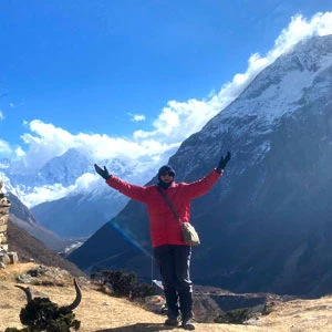
As you arrive at Ama Dablam Base Camp, you will be rewarded with jaw-dropping views of Ama Dablam itself with Everest, Lhotse, Nuptse, and Kangtega in the distance. This base camp is set on a broad, flat expanse of rocky grassland surrounded by towering cliffs and glacial moraines. 

Trekking Towards Gokyo Valley

After reaching the base camp, you will again come back to Pangboche before taking an unconventional turn away from the busy Everest route toward the less-trodden village of Phortse. Often overlooked, Phortse is a hidden gem perched on a hillside and is known for producing some of Nepal’s most accomplished mountaineers. 

The route to this village is quite secluded and Phortse itself is surrounded with forests of juniper and rhododendron. Here, Phortse is also home to the Sherpas, the well-known mountaineers of the world. Their intimate knowledge of the mountains and centuries-old mountaineering traditions have made them essential partners to countless Everest expeditions. 

Passing Phortse, you will have two route options to reach Gokyo: via Dole or via Thare. The right-side route via Thare is more secluded with fewer crowds but the path can be more difficult and untamed. Similarly, the left side route via Dole is more managed but you may encounter a few trekkers along the way.

To trek via Dole, you will need to ascend through alpine terrain. Dole is a tranquil village nestled in a hanging valley surrounded by waterfalls and grazing yaks. Climbing higher from here, you will pass Lhabarma and Luza, where the air gets thinner and the landscape turns stark and dramatic. 

The route then brings you to Machhermo, a wind-swept village with a tragic past. Back in 1974, a massive avalanche struck the village which left devastating damage. Today, Machhermo is also known for the myth of the Yeti, and while in here, you will hear legends passed down through generations.

Next, you will reach the stunning Gokyo Valley which is home to the sacred Gokyo Lakes. These lakes are among the highest freshwater lakes in the world and are considered holy by both Hindus and Buddhists. The largest lake, Dudh Pokhari, sits beside Gokyo Village, a remote outpost of stone lodges and yak herders. 

While in Gokyo, you will prepare for one of the trek’s most rewarding experiences: the pre-dawn climb up to Gokyo Ri (5,357 meters). The view from the summit is nothing short of breathtaking with an unbroken chain of the world’s tallest peaks, including Everest, Cho Oyu, Lhotse, and Makalu.

To reach this viewpoint, you will trek up a rocky ridge with loose gravel underfoot. As you climb higher, the air thins, and the temperature drops, but the landscape becomes ever more dramatic. About halfway up, you will witness a series of rock cairns and fluttering prayer flags. Likewise, the final stretch of the climb is tough but steady.

The Crossing of Renjo La Pass

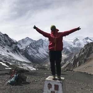
From Gokyo, you will make your way towards Lungdhen via its adventurous climax with the crossing of Renjo La Pass (5,360 meters). The ascent to this pass is steep and often snow-covered, but the panoramic view from the top is breathtaking as it overlooks the entire Gokyo Valley and beyond. 

You will begin the ascent to Renjo La Pass from the western edge of Dudh Pokhari. Here, the terrain quickly becomes steeper and more rugged as you begin climbing toward the pass. The air is thin, and progress is slow, with each step revealing more of the surrounding peaks. 

Along the way, you will pass large boulders, alpine meadows, and icy stream crossings. As you near the top of the pass, the landscape becomes barren and dramatic. But once you reach the top, you are treated to one of the finest panoramic vistas in all of the Himalayas. 99

From here, the descent takes you into the remote Bhote Koshi Valley, where you will pass through Lungdhen, a sleepy village with Tibetan roots. The village itself is small with a handful of traditional stone lodges and homes scattered along a rugged slope. 

The residents are mostly Sherpa and Tibetan descendants who have lived in the region for generations. Here in Lungdhen, you will witness prayer flags fluttering across each rooftop, stone mani walls carved with Buddhist inscriptions, and occasional chortens that dot the landscape.

The surroundings here are arid and wind-swept, with dramatic ridgelines, dry grasslands, and views of distant peaks like Cho Oyu and Cholatse. The Bhote Koshi River gurgles down the valley below. 

Leaving this village behind, the trail eventually reconnects with the Everest route near Namche, and from there, you retrace your steps back to Lukla.

Why Ama Dablam Base Camp with Gokyo Valley Trek instead of the Everest Base Camp?

Choosing the Ama Dablam Base Camp with Gokyo Valley Trek over the traditional Everest Base Camp (EBC) route offers a more serene, scenic, and culturally immersive Himalayan adventure. While the EBC trek is iconic and undoubtedly popular, the route often becomes congested, especially during peak trekking seasons. In contrast, the Ama Dablam and Gokyo Valley trail leads you through quieter and less-trodden paths within the Himalayas.

One of the unique draws of this trek is that you still get to visit a dramatic Himalayan base camp, Ama Dablam Base Camp, without the overwhelming foot traffic of Everest Base Camp. You will likely share the trail with only a handful of other trekkers.

Similarly, the Gokyo Valley section adds even more magic to the journey. Instead of retracing a linear trail like EBC, you will get to explore a circular route that crosses the high Renjo La Pass and opens into the majestic Gokyo Lakes. Climbing Gokyo Ri rewards you with one of the most breathtaking Himalayan panoramas, offering views of Everest, Lhotse, Makalu, and Cho Oyu in one sweeping gaze.

Moving on, the cultural experience is equally rich. You will pass through authentic Sherpa villages, where life remains deeply rooted in tradition. Unlike the busy tea-house chains you will find along the EBC route, these villages offer a more personal and grounded feel. 

Furthermore, the physical challenge is well-balanced. While the trek takes you to high altitudes, including the Renjo La Pass at over 5,300 meters, the balanced itinerary with acclimatization days makes it bearable. 

In short, if you are looking for stunning mountain scenery, fewer crowds, meaningful cultural interaction, and a genuine Himalayan wilderness experience, then the Ama Dablam Base Camp with Gokyo Valley Trek is a compelling and fulfilling alternative to Everest Base Camp.

Useful Information

Difficulty of Ama Dablam Base Camp With Gokyo Valley Trek

The Ama Dablam Gokyo Valley Trek is a moderately challenging Himalayan adventure. This trek demands strong physical endurance, mental resilience, and adaptability to high-altitude environments. 

While it doesn’t require technical climbing skills, you will need to have prior experience in high-altitude trekking to tackle its combination of steep ascents, high-altitude passes, and long trekking hours.

Altitude And Its Effects

One of the most significant challenges on this trek is the high altitude. The journey begins in Lukla (2,860 meters) and gradually ascends to Ama Dablam Base Camp (4,600 meters) and later to Gokyo Ri (5,357 meters) and Renjo La Pass (5,360 meters). 

At these elevations, the oxygen level drops to nearly 50% compared to sea level, which can lead to Acute Mountain Sickness (AMS) if proper acclimatization isn’t followed. Therefore, you must be alert to symptoms like headaches, dizziness, fatigue, and shortness of breath.

Terrain And Trail Conditions

During this trek, you will trek from gentle forest paths and stone-paved village trails in the lower sections, to steep ascents through rocky moraines and snow-dusted ridges in the higher reaches. Here, the trail from Pangboche to Ama Dablam Base Camp features rough alpine tracks and some narrow, exposed sections. Likewise, the ascent to Gokyo Ri includes loose scree and sharp climbs.

Among many such days during the trek, crossing Renjo La Pass is the toughest with its long, strenuous push over snow-covered trails and boulder fields. Similarly, even its descent is equally taxing on the knees.

Daily Walking Hours And Physical Fatigue

Most trekking days involve 5 to 7 hours of walking, with some pushing beyond 8 hours, depending on your pace and high-altitude segments. Hence, with the cumulative effect of altitude, terrain, and distance, you will be physically fatigued, especially if you haven’t trained adequately before the trek.

At higher elevations, your body will also work harder. Hence, along the way, you may struggle with sore muscles and burnout. 

Unpredictable Weather

Weather in the Himalayas is notoriously unpredictable. The bright sunny mornings can quickly turn into foggy afternoons or sudden snowstorms, especially in higher regions like Gokyo and Renjo La. Due to such, rain or snow can make the trails slippery and increase the risk of injury or delay.

Best Time For Ama Dablam Gokyo Trek

The Himalayas dramatically change with the seasons, each offering its own mood, advantages, and challenges. Here’s a complete seasonal breakdown to help you choose the right time for your adventure.

Spring (March to May)

Spring is one of the most popular and ideal times to embark on this trek. As Winter fades away, the skies remain clear, and the air feels crisp and fresh. During this season, you will find blooming rhododendron forests at lower altitude.

Generally, the trails are dry and stable, making the ascent easier and safer. Often daytime temperatures range from 10°C to 15°C at lower elevations, while higher areas remain colder, often dipping below -5°C at night.

Additionally, you will also catch a glimpse or two of the area’s wildlife from Himalayan tahrs to colorful pheasants.

Autumn (September to November)

Autumn is often hailed as the best season overall for this trek. After the Summer Monsoon, the dust settles and the landscape looks lush and refreshed. Similarly, you will get unmatched visibility of the high peaks, especially Ama Dablam, Everest, and the Gokyo lakes region.

With temperatures hovering between 12°C and 18°C during the day and dropping to -10°C or lower at night, the air is also comfortable for trekking. During these months, the sky stays deep blue, and at  night, the sky is blanketed with stars.

Moving on, the trails are dry, and water crossings are more manageable. It is also festival season, Dashain and Tihar, which is Nepal’s biggest Hindu celebrations.

Off Seasons: Winter & Monsoon

During Winter (December to February), the region becomes much quieter and unbearably cold. The trails above 4,000 meters, especially to Gokyo Ri and Renjo La Pass can get blanketed in snow.

Due to such, navigating the area will be riskier and much worse, the entire region will be closed. You should expect the temperature to drop to -15°C to -20°C at night with strong winds. 

On a similar note, Monsoon (June to August) brings heavy rains, muddy trails, landslides, and leech-infested paths at lower altitudes. Cloud cover often obstructs mountain views, and flight delays between Kathmandu and Lukla are common due to poor visibility. 

That said, Nepal Trekking Experts do not recommend trekking during the Monsoon and Winter, unless you are extremely experienced and have flexibility in your schedule.

Permits Required For Ama Dablam Gokyo Trek

To trek to Ama Dablam Base Camp with the Gokyo Valley extension, you will need two official permits. 

Khumbu Pasang Lhamu Rural Municipality Entrance Permit

Once you land in Lukla, you will need to secure the Khumbu Pasang Lhamu Rural Municipality Entrance Permit. This permit is mandatory for all trekkers entering the Khumbu region, and it cannot be acquired in Kathmandu in advance. The local municipality office in Lukla issues this permit upon arrival. The fee is NPR 3,000 per person (approximately USD 22 to 25).

Sagarmatha National Park Entry Permit

Next, you will need the Sagarmatha National Park Entry Permit. This permit can be obtained in two ways: either from the Nepal Tourism Board Office in Kathmandu or at the Park Entry Gate in Monjo. The cost is also NPR 3,000 per person. If you are trekking with a guide or through a company, they will arrange this in advance.

Transportation: Flight From Kahmandu to Lukla

The journey to Lukla begins with a thrilling 45-minute flight from Kathmandu to Tenzing-Hillary Airport. As the plane lifts off, you will enjoy sweeping aerial views of the Kathmandu Valley, followed by stunning Himalayan panoramas featuring Everest, Lhotse, and Ama Dablam. 

If you are trekking in Spring or Autumn, heavy trekking traffic can lead to flight congestion or delays. To avoid this, you can alternately fly from Kathmandu to Ramechhap (Manthali Airport) or take a 4 to 5-hour drive from the capital, before catching a shorter flight to Lukla. Though this option adds road time, this alternative boosts your chances of flying on schedule, especially in peak seasons.

Accommodation

Accommodation during this trek primarily consists of locally run tea houses, which offer a warm and authentic Himalayan experience. These accommodations are simple yet functional. 

You will sleep in twin-sharing rooms with wooden or stone walls, equipped with basic bedding like a mattress, pillow, and blanket. While rooms are cozy, there’s no in-room heating, so you must carry your own sleeping bag.

Additionally, hygiene standards are generally fair, with most tea houses maintaining clean dining areas and tidy rooms. However, bathrooms are usually shared, and flush toilets might be replaced with squat toilets in more remote villages. 

In lower villages like Namche or Phakding, you may find attached bathrooms, but you will no longer find such as you ascend higher. Likewise, the higher you go, the hot showers become rarer. When available, they are typically powered by gas or solar heaters, for an extra fee. 

Meals

Meals during this trek are a hearty mix of traditional Nepali staples and familiar international dishes, prepared fresh in the tea houses. While the options may not be gourmet, the food is nourishing, comforting, and perfectly suited to fuel long days on the trail.

For breakfast, most tea houses serve a combination of toast, pancakes, porridge, muesli, eggs (boiled, scrambled, or omelet), and Tibetan bread. You can also choose to pair these with a steaming cup of milk tea, black tea, fresh coffee, or a traditional butter tea for a local touch. 

Lunch typically includes a mix of dishes like fried noodles, vegetable rice, Tibetan-style thukpa (noodle soup), momos (dumplings), and spaghetti. However, the star of the menu is undoubtedly Dal Bhat, a traditional Nepali set meal of rice, lentil soup, seasonal vegetables, and pickle. 

Lastly, dinner options are generally the same as lunch. But after a long day, you can opt for garlic soup, as it helps with altitude sickness. In places like Gokyo and Namche, you can even find yak cheese pizza or Sherpa stew.

For drinks, you will have plenty of options: herbal teas, lemon ginger honey tea, black coffee, and hot chocolate. Now, you will also get bottled or boiled water along the trail.

Telephone, Internet, And Charging During Ama Dablam Gokyo Trek

Telephone Service

Throughout the Ama Dablam Base Camp with Gokyo Valley trek, mobile phone coverage is available but patchy. Ncell and Nepal Telecom (NTC) are the two major service providers in the region. 

Among the two, NTC tends to offer better connectivity in high-altitude areas like Tengboche, Dingboche, and Gokyo. However, you will face frequent network drops in remote sections such as Renjo La Pass or Lungdhen. Now, you can buy a local SIM card in Kathmandu before your trek and top it up with data or voice packages.

Charging Facility

Most tea houses allow you to charge your devices but it comes at a cost. Since the villages heavily rely on solar power or small hydropower units, charging fees increase with altitude, typically ranging from NRs 200 to 500 per hour per device. 

In lower villages like Namche Bazaar, charging is often free or reasonably priced, but once you climb higher, especially in places like Gokyo or Pangboche, it gets more expensive when available. Therefore, NTE recommends you to carry a power bank or solar charger.

Wifi Connection

Wi-Fi is available in many tea houses along the route, especially in popular villages like Namche Bazaar, Tengboche, Dingboche, and Gokyo. However, the connection is often slow and unstable, especially during bad weather or when many trekkers try to log in at once. Most tea houses charge a fee for access, usually NRs 300 to 700 per device per day. 

Ama Dablam Gokyo Trekking Gear Checklist

Clothing

Thermal tops and bottoms(merino wool or synthetic)

Fleece or down jacket

Waterproof and windproof jacket and trouser

Quick-dry hiking shirts and pants

Lightweight insulated pants

Breathable underwear

Wool or fleece hat

Lightweight gloves

Footwear

Wool or synthetic trekking socks

Warm thermal socks

Well-broken-in trekking boots (waterproof)

Lightweight camp shoes or sandals

Gear & Equipment

Trekking backpack (35 to 50L with rain cover)

Four-season sleeping bag (rated to -10°C or lower)

Adjustable trekking poles 

Sunglasses with UV protection

Headlamp with extra batteries

Personal Items

Sunscreen (SPF 30+)

Lip balm (SPF 15+)

Personal first-aid kit (blister treatment, painkillers, altitude medication like Diamox, etc.)

Prescription medications (if any)

Water bottle with purification tablets or filter

Quick dry towel

Toiletries (toothbrush, toothpaste, floss, wet wipes, face towels, hand sanitizer, travel-sized soap and shampoo)

Travel Insurance

As this high-altitude trek takes you well above 5,000 meters, you will be trekking in remote areas where access to medical care is limited. Similarly, if any unforeseen circumstances  arises, evacuation by helicopter is often the only viable option in emergencies. That’s why your travel insurance must explicitly include coverage for trekking at elevations up to 6,000 meters, along with emergency helicopter rescue. 

While buying a policy, you must carefully read the details or speak directly with the insurer to confirm coverage. Your insurance policy for this trek should cover emergency medical expenses, evacuation by helicopter, trip cancellations or interruptions, loss or delay of baggage, theft, and accidents or injuries that occur during the trek. 

Furthermore, you must also carry both printed and digital copies of your insurance documents and share them with your trekking agency or guide. 

Porter

While the Ama Dablam Base Camp with Gokyo Valley Trek package may not include a porter by default, you can certainly hire one. Hiring a porter is a practical choice, especially given the trek’s high altitude, long daily walking hours, and challenging terrain. 

Porters are experienced locals who can carry up to 20 kg of your gear, allowing you to walk with just a light daypack. They will help reduce the physical strain on your body and enhance your overall trekking experience. 

Without the weight of a full backpack, you can walk more comfortably, maintain a steady pace, and conserve energy for the more demanding sections of the trail. Moving on, hiring a porter also supports the local economy directly. Many porters come from mountain villages and rely on seasonal trekking jobs to sustain their families. By employing them, you are contributing to the livelihood of the region.

Itinerary
  • Overnight Altitude:1400 meters/4593 feet
  • Accommodation:3 star hotel

Your adventure begins as you land in the vibrant capital of Nepal, Kathmandu, a city alive with ancient heritage, colorful streets, and centuries-old temples. Upon arrival at Tribhuvan International Airport, your guide will greet you and transfer you to your hotel. The rest of the day is free to rest after your flight or stroll around the bustling tourist hub of Thamel, where you will get your first taste of local food and Nepali hospitality.

  • Overnight Altitude:1400 meters/4593 feet
  • Meals:Breakfast
  • Accommodation:3 star hotel

Today is set aside for final trek preparation. You can use this day to check your gear, do last-minute shopping for essentials, and attend a short briefing session with your guide. You may also explore nearby heritage sites like Swayambhunath (Monkey Temple) or Pashupatinath Temple, or simply enjoy a relaxing day in the city while adjusting to the altitude before heading to the mountains.

  • Overnight Altitude:2610 meters/8563 feet
  • Meals:Breakfast, Lunch and Dinner
  • Accommodation:Tea house

This day, you will take a 45-minute flight to the thrilling mountain airstrip of Lukla, often considered one of the most scenic flights in the world. During the flight, you will get breathtaking aerial views of the Himalayas, including Everest and Lhotse. 

From here, you begin your trek to Phakding, descending through a forested trail past traditional Sherpa villages. After crossing several suspension bridges draped with prayer flags, you will arrive at Phakding, a small but lively village on the banks of the Dudh Koshi River. 

It’s a popular first-night stop for Everest trekkers, and you will already start feeling the charm of Sherpa hospitality here. Nestled at an altitude of 2,610 meters, Phakding is surrounded by lush pine forests and the steady hum of the Dudh Koshi River.

  • Overnight Altitude:3440 meters/11286 feet
  • Meals:Breakfast, Lunch and Dinner
  • Accommodation:Tea house

After a warm breakfast and final pack check, you will hit the trail by 7:30 AM. The air is fresh and crisp, and the path begins gently, winding through a string of charming Sherpa villages.

As you walk, the Khumbu landscape begins to open up. You will witness majestic peaks like Thamserku (6,623 meters). Align the way, you will also cross several steel suspension bridges strung high above the rushing river.

Around mid-morning, you will reach Monjo (2,835 meters), the official entry point to Sagarmatha National Park. Here, you will stop to obtain your national park permit. You can also take a moment to check the featured maps and information boards in this checkpoint.

From Monjo, you will dip down to the river and get the town Jorsalle. After refueling amidst the pine and rhododendron forests, you will take a steep, winding ascent to Namche Bazaar. You will walk through dense woods, and if the sky is clear, you will catch your first glimpse of Mount Everest peeking between the ridges.

The final stretch into Namche Bazaar is a push. You will arrive in Namche by late afternoon and after checking into your lodge, you will have time to freshen up, sip some hot tea, and wander through the bustling alleyways.

  • Overnight Altitude:3440 meters/11286 feet
  • Meals:Breakfast, Lunch and Dinner
  • Accommodation:Tea house

Today, you slow down but for good reason. At this altitude, your body needs time to adjust to the thinning air, and Namche Bazaar is the perfect place to do just that. You can begin the morning with a light hike up to the Everest View Hotel, situated at 3,880 meters. 

This trail winds past old stone walls and hardy alpine shrubs before opening up to jaw-dropping views. From the terrace of the hotel, you will get to see Mount Everest, Lhotse, Ama Dablam, and Thamserku rise like silent giants in the sky. 

This side hike is a part of the acclimatization process. By ascending to a higher elevation and then returning to sleep lower, your body gradually adapts to the altitude. If you do not want to take this side hike, you can also spend the day exploring Namche Bazaar.

Traditionally, Namche is a trading post between Tibet and Nepal and today, it is a bustling mountain town filled with colorful shops, cozy bakeries, gear outlets, and cafes. If it’s a Saturday, you will get to experience the weekly market in the center of the village. Here, local Sherpas, traders, and yak herders gather here to sell everything from vegetables and cheese to Tibetan crafts and second-hand trekking gear. 

If you are curious about local culture and mountaineering history, you can also visit the Sherpa Culture Museum or the Sagarmatha National Park Visitor Center. These places showcase artifacts, photographs, and detailed information about the first Everest summits, the unique flora and fauna of the region, and the deeply spiritual traditions of the Sherpa people.

  • Overnight Altitude:3860 meters/12664 feet
  • Meals:Breakfast, Lunch and Dinner
  • Accommodation:Tea house

As the morning sun brushes over the stone rooftops of Namche, you will begin your trek to Tengboche. The trail initially starts gently, tracing the ridgeline high above the Dudh Koshi River. 

Almost immediately, you will be rewarded with panoramic views of Everest, Lhotse, Ama Dablam, and Thamserku. As you move forward, the trail winds through dense forests of rhododendron, pine, and juniper. If you are trekking in Spring, the rhododendrons light up the trail in vibrant pink and red, and if you are trekking in Autumn, golden leaves crunch underfoot.

Along the way, you will pass chortens, mani walls, and prayer flags fluttering in the breeze. After about two and a half hours into the trek, you will descend steeply to the riverside hamlet of Phunki Tenga. The sound of the river is calming here, and you might spot Himalayan monals or other birdlife. 

From here, you will begin the steep ascent to Tengboche. The forest will thicken again and you will get occasional glimpses of snowy peaks through the trees. After nearly two hours of climbing, the trees begin to thin, and suddenly, Tengboche Monastery emerges. 

This monastery is set against the backdrop of Ama Dablam. It is one of the oldest monasteries in the Himalayas. As you reach here, you will witness monks in crimson robes walk silently across the courtyard, prayer flags whip in the wind, and if you are lucky, you will get to witness a chanting ceremony echoing through the monastery walls.

  • Overnight Altitude:3985 meters/13074 feet
  • Meals:Breakfast, Lunch and Dinner
  • Accommodation:Tea house

Today, you will continue trekking deeper into the Khumbu Valley. The path from Tengboche to Pangboche is shorter and gentler than the previous day.

You will first descend gently through a tranquil forest of birch, rhododendron, and fir. The trail is soft underfoot and draped in moss, and if you are trekking in Spring, you will see vibrant rhododendrons bloom in brilliant shades of pink and red. 

As the trail winds along the ridge, Ama Dablam dominates the horizon. The closer you get, the more it feels like the mountain is watching over the valley. Along the route, you will cross small wooden bridges over mountain streams, and pass carved mani stones, spinning prayer wheels.

After about two to three hours of relaxed trekking, you will reach Pangboche, one of the oldest and most authentic Sherpa settlements in the Khumbu region. The village sits on a terraced slope, surrounded by juniper bushes and craggy cliffs, with commanding views of Ama Dablam and the distant Everest ranges. The air here feels colder, cleaner, and charged with the energy of the high Himalayas.

This village is rich in culture and history. You will find the Pangboche Monastery, said to be the oldest in the region, home to sacred relics and ancient legends. The locals here are mostly Sherpa and deeply spiritual with their lives rooted in Tibetan Buddhism. Many of the renowned Everest climbers hail from this very village.

  • Overnight Altitude:3985 meters/13074 feet
  • Meals:Breakfast, Lunch and Dinner
  • Accommodation:Tea house

This day brings one of the major highlights of the trek: reaching the Ama Dablam Base Camp. Today’s route takes you to the south-east, immediately rising across open yak pastures tufted with alpine grass. The path is well-trodden which later changes to a narrow, rocky path clinging to the hillside. 

From here the scenery shifts: juniper shrubs give way to bare moraine and ochre-tinted scree. The air grows thinner and drier. You will push steadily upward, switch-backing across grey sand and polished boulders.

About halfway, you will see three valleys converge: Pangboche, Imja Khola, and the snow-white slopes rolling toward Everest. Moving on, the final pull to base camp feels raw and elemental. The base camp is broad, wind-flattened meadow filled with boulders and yak-chewed tufts.

Once you are here at  the base camp, you will drop your pack, let your pulse settle, and take it all in. Ama Dablam will tower directly overhead with its famed hanging glacier, the “dablam,” or mother’s sacred pendant. On your west side, you will spot Everest, Lhotse, and Nuptse crowding the horizon.

You can explore this base camp by chatting with your guide, spinning the solitary prayer wheel near the climbers’ memorial, or simply sitting on a sun-warmed stone and feeling the immensity of 6,812 meters of sculpted ice above you. 

Soon after, you will prepare for the descent, retracing your steps. Along the way, you may spot blood pheasants or Himalayan tahr. Crossing the bridge again, you feel the temperature rise and the scent of juniper return.

By lunch time, you will reach Pangboche again. Now, you can spend the rest of the day lounging in the teahouse garden.

  • Overnight Altitude:4200 meters/13780
  • Meals:Breakfast, Lunch and Dinner
  • Accommodation:Tea house

Today’s trail takes you gently as you descend through yak pastures, retracing your steps briefly before veering off to the lesser-traveled Phortse trail. As you follow this high-altitude trail, the trek rewards you with breathtaking views of the Gokyo Valley ridgelines across the Dudh Koshi River. 

Unlike the main Everest route, the path here feels remote, peaceful, and steeped in authenticity. You will pass beneath cliffside chortens, through rhododendron groves, and along narrow ledges.

By mid-morning, you arrive at Phortse, a picturesque Sherpa village clinging to the mountainside at 3,840 meters. Phortse is known for its deep mountaineering roots. Here,  you can pause to catch your breath and chat with locals, many of whom are descendants of high-altitude porters and guides. 

After Phortse, the trailis going down to the Dudh Koshi River, cross the suspension bridge then climbs steadily toward Dole. The terrain transitions into alpine meadows strewn with boulders and wildflowers. You will trek past small waterfalls and cross high wooden bridges.

The final stretch of this trek is a steady uphill pull through fir and birch forest. By mid-to-late afternoon, you will arrive in Dole, a quiet settlement nestled on a gentle slope.

  • Overnight Altitude:4470 meters/14665 feet
  • Meals:Breakfast, Lunch and Dinner
  • Accommodation:Tea house

You start your trek from Dole around 7:30 AM ascending steadily through open alpine terrain. The trail then transitions to windswept grasslands and expansive views of the valley below. With every step, Cho Oyu begins to dominate the skyline ahead.

The path from Dole is peaceful and less crowded, threading along the side of the valley above the Dudh Koshi River. You will walk past small stone chortens, fluttering prayer flags, and ancient mani walls carved with sacred Tibetan inscriptions. As you gain altitude, the landscape becomes stark yet mesmerizing with rocky outcrops, dwarf shrubs, and the occasional sighting of Himalayan tahr or pheasants.

Midway through the trek, you will stop at Luza, a small seasonal settlement clinging to the hillside. Here, you may meet yak herders or local porters. From Luza, the trail becomes more exposed. You will feel the altitude with every breath, and the pace slows to match the thinning oxygen. 

Soon, the terrain dips slightly and then rises again gently as you approach Machhermo. You will see small glacial streams run beside the trail, and if you are lucky, you might spot the start of icy rivulets that eventually feed into the turquoise Gokyo Lakes.

Altogether, you will reach Machhermo by early afternoon, greeted by stone lodges and fluttering prayer flags. This is a vital stop for acclimatization before you head deeper into high-altitude terrain.

  • Overnight Altitude:4790 meters/15715 feet
  • Meals:Breakfast, Lunch and Dinner
  • Accommodation:Tea house

From the very start of the day, the trail will lift your spirits with its dramatic beauty. Today’s path ascends gently at first, guiding you along the western edge of the Dudh Koshi valley. 

You will hike across rocky, frost-covered pastures and narrow ridgelines, crossing glacial melt streams and listening to their icy gurgle. Gradually, you approach the terminal moraine of the Ngozumpa Glacier, the longest glacier in Nepal.

As you climb, the terrain becomes more rugged, with the trail winding through stone staircases and loose moraine paths. You will pass by a series of shimmering turquoise lakes. The first lake is Longpongo, sacred to locals. The second lake is Taboche Tsho which offers breathtaking views of snowy reflection in the lake. 

Continuing on, the trail will gently climb toward the third and largest lake, Dudh Pokhari, which sits beside the peaceful village of Gokyo. You will reach this magical place by midday. The sight here is breathtaking with Cho Oyu looming above the lake to the north.

All in all, Gokyo is calm and dreamlike, set against a backdrop of dramatic snowy summits and surrounded by glacial beauty. Locals here are mainly Sherpas who manage the lodges and welcome you with warm smiles and hot meals. In the afternoon, you are free to rest or stroll along the lake’s edge, watch yak caravans arrive with supplies, or simply sit in awe of the panoramic Himalayan silence.

  • Overnight Altitude:4790 meters/15715
  • Meals:Breakfast, Lunch and Dinner
  • Accommodation:Tea house

Today, you will rise before dawn, around 4:30 AM. After a quick cup of hot tea, you will then begin the climb to Gokyo Ri, one of the most spectacular vantage points in the entire Himalayas. The trail wastes no time, it is steep from the very first step. 

As you ascend, you will gain elevation quickly. The air grows thinner, and the silence of the mountains becomes more intense. As the sun starts rising, you will get sunrise views of Cho Oyu, Everest, Lhotse, and Makalu in soft orange and pink hues.

The final stretch of today’s hike is tough. After about 2 to 3 hours of steady climbing, you reach the summit of Gokyo Ri (5,357 meters). Below, you will witness the turquoise Gokyo Lakes shimmer in the morning light. To the east, you will see Mount Everest towering majestically behind the Ngozumpa Glacier.

After soaking it all in, photographing, meditating, or simply sitting in awe, you will descend back to Gokyo. As you descend, the village reappears like a peaceful postcard nestled beside the lake. You will return around late morning, just in time for a warm breakfast. The rest of the day is yours to rest, wander through the quiet village paths, chat with fellow trekkers, or simply enjoy the alpine stillness.

  • Overnight Altitude:4380 meters/14370 feet
  • Meals:Breakfast, Lunch and Dinner
  • Accommodation:Tea house

Today’s adventure will lead you over one of the most stunning and lesser-traveled high Himalayan passes: Renjo La. As you leave Gokyo behind, the trail gradually becomes steeper and more rugged, weaving through loose moraine, stone steps, and boulder-strewn switchbacks.

As you climb, the terrain grows more dramatic. However, each turn will offer jaw-dropping views: the jagged ridges of the Ngozumpa Glacier, the quiet shimmer of Gokyo’s lakes below, and in the distance, the silhouettes of Everest, Lhotse, Makalu, and Cho Oyu. The ascent to Renjo La is challenging, especially as you approach the top.

At the summit, you will find the wind to be strong and wild as prayer flags dance furiously. From here, you will get to experience the rare angle of Everest and its surrounding peaks, framed by remote valleys and endless ridgelines.

After resting for a while at the top, the descent is steep and technical at first. Here, you will also pass small yak pastures and isolated stone huts as the trail winds down into the Bhote Koshi Valley.

Eventually, you will reach the quiet village of Lungdhen, a peaceful Sherpa settlement that rests in a windswept hollow. Far from the buzz of trekkers, Lungdhen offers calm, raw Himalayan beauty and a chance to witness the more secluded rhythm of mountain life.

  • Overnight Altitude:3440 meters/11286 feet
  • Meals:Breakfast, Lunch and Dinner
  • Accommodation:Tea house

This day, you will leave behind the quiet solitude of Lungdhen. As the sun slowly rises over the surrounding ridgelines, you will set off on a descending trail that gently follows the Bhote Koshi River. This stretch of the trek feels timeless, scattered with ancient stone walls, old trade paths, and traditional Sherpa homes.

Align the way, you may see locals tending to yaks and drying herbs in the sun. The cultural landscape here is rich with stone mani walls, spinning prayer wheels, and small chortens.

As you descend further, the air grows warmer, and pine forests begin to reappear. During the hike you will pass through some beautiful town like Thame, Thamo etc. From here, the trail becomes more defined and bustling, gently leading you toward Namche through a forested path adorned with rhododendron, juniper, and the occasional flutter of Himalayan monals.

Crossing suspension bridges and winding past hillside cliffs, you will reach Namche Bazaar by late afternoon. The vibrant atmosphere of the village welcomes you back after days in remote terrain.

  • Overnight Altitude:2860 meters/9383 feet
  • Meals:Breakfast, Lunch and Dinner
  • Accommodation:Tea house

Today  is the final leg of this trek. After a hearty breakfast and a last glance at the bustling marketplace, you will descend along the familiar stone-paved trail. The initial descent to the Hilary Suspension Bridge is steep and demands careful footing. You will also take in your last panoramic views of Ama Dablam, Lhotse, and Everest. 

Along the way, you will again pass through charming Sherpa villages like Monjo and Phakding. If time allows, you may stop for a short tea break and chat with locals. As you move forward, the trail gently rises and falls alongside the river. The final ascent to Lukla is gradual.

Reaching Lukla by late afternoon, you will settle into your tea house, sip on a warm drink, and reflect on the unforgettable journey.

  • Overnight Altitude:1400 meters/4593 feet
  • Meals:Breakfast
  • Accommodation:3 star hotel

After a warm and last breakfast in the Himalayas, you will head to Tenzing-Hillary Airport. Once the weather is favorable and the air traffic clears, you will board a small twin-otter plane. During this 45-minute flight, you will catch one final glimpse of the trails you have conquered.

Soon, you will land in the hustle and bustle of Kathmandu. From the airport, your guide will transfer you to your hotel where you can finally relax, take a hot shower, and reflect on the incredible adventure.

  • Meals:Breakfast

Your journey comes to a graceful close as you prepare for your departure from the vibrant capital of Kathmandu. Depending on your departure time, you can step out for a last stroll through the bustling streets of Thamel, pick up a few souvenirs, or sit quietly at a nearby stupa. When it’s time, a private vehicle will transfer you to Tribhuvan International Airport.

Got a question about this tour?

Or looking for customize trip, reach out to our travel experts.

Customize Trip

Note

The above itinerary is a guideline. If you're not satisfied or have an alternative plan please feel free to discuss it with us. (We provide city tours on request)

What's Included
Cost Includes
  • Complimentary airport picks up and drops off
  • Complimentary welcome dinner
  • Three-night stay in Kathmandu with breakfast included 
  • All necessary trekking permits such as Sagarmatha National park, TIMS card, etc.
  • Flights to and from Lukla
  • All accommodations during the trek
  • Three meals a day during the trek
  • A cup of tea or coffee each time with the meal
  • Fresh fruit each day if and when available
  • Complimentary duffel bag, down jacket, trekking map, and sleeping bag if needed
  • Government-trained first-aid trained professional local guide who speaks English
  • First-aid kit
  • Staff insurance, meals, accommodation, equipment, transportation, etc.
  • Rescue arrangements if necessary
  • Agency service charge and government tax/VAT
  • Certificate of achievement
Cost Excludes
  • International airfare and Nepal visa fee
  • Lunch and Dinner in Kathmandu
  • Porters to carry your backpacks (we provide porters on request)
  • Personal Insurance, personal expenses, loss of property and theft, etc.
  • Sightseeing costs in the city. (temples, monasteries entrance fee, etc.)
  • All beverages, snacks, and additional expenses such as laundry, hot showers, battery charging, Wifi, etc.
  • Additional cost due to natural calamities and unforeseen circumstances
  • Tip to staff 
Route MapDownload Map
Ama Dablam Base Camp with Gokyo Valley Trek map
Dates & Availability
Start:SaturdayAug 16, 2025
End:MondaySep 01, 2025
PriceUS$1690
StatusGuaranteed
Start:SaturdayAug 23, 2025
End:MondaySep 08, 2025
PriceUS$1690
StatusGuaranteed
Start:SaturdayAug 30, 2025
End:MondaySep 15, 2025
PriceUS$1690
StatusGuaranteed

Note

Are you satisfied with the group departure dates? Aside from that, we organize private trips or any special dates you prefer. Let's discuss to our local specialist now.

Photos & Videos
FAQs for Ama Dablam Base Camp with Gokyo Valley Trek
  • It’s a moderately challenging trek suitable for fit trekkers with prior hiking experience.

  • The highest point of this trek is Renjo La Pass at 5,360 meters (17,585 feet).

  • You will need the Khumbu Pasang Lhamu Rural Municipality Permit and the Sagarmatha National Park Entry Permit.

  • Spring (March to May) and Autumn (September to November) are the best seasons for this trek as they offer the best weather and views.

  • No, porters are not included but can be hired on request.

  • Yes, drinking water is available. You can refill bottles at tea houses or along the way from the natural sources. However, NTE recommends you to treat the water before drinking.

  • Wi-Fi and charging are available at most tea houses for an extra cost, but connections may be slow.

  • Yes, insurance covering high-altitude trekking and emergency evacuation is mandatory for this trek.

  • Yes, but coverage is patchy and depends on location and provider (mainly Ncell or NTC).

You may also like
Related Packages
Call us on WhatsApp+977 9841917136OrChat with us
Consult with a Travel Expert

Do you have any questions about the trips? Contact our travel experts in various countries.

Plan Your TripJoin Our Newsletter